Geoawareness
Through Mission Planner it is possible to handle the mandatory proximity warnings to the No-Fly-Zones defined by the European Normative.
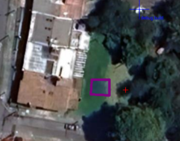
Upload the No-Fly Zones
While the European Authority has defined the format for No-Fly Zones, it has not yet provided a shared database accessible to all drone operators. However, Mission Planner allows you to define local No-Fly Zones using the approved format.
Steps to Upload No-Fly Zone Definitions:
-
Create a JSON file containing the No-Fly Zone definitions following the format approved by the European Authority.
-
Name the file:
eunfz.json -
Place the file in the folder:
Program Data\Mission Planner(This folder is hidden on the C drive.)

Figure 40. Upload the No-Fly Zones
At startup, Mission Planner will attempt to read the file eunfz.json located at:Program Data\Mission Planner
Geoawareness Operating Status
The Geoawareness system may be off in the following cases:
- The
eunfz.jsonfile is not found in the specified location. - The polygon definitions within the
eunfz.jsonfile do not follow the correct syntax.
GPS Signal Loss
If the drone loses GPS signal:
- The Geoawareness polygons will still appear on the HUD.
- However, the system cannot compute the drone's distance relative to the Geoawareness polygon boundaries due to the unknown position.
In this scenario, a navigation failsafe will trigger. For more details, refer to PART C, section 5.3.
Threshold to Alert
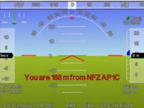
Mission Planner is configured to throw a proximity warning when the drone is within 200 meters of the NFZ boundary. However, due to certain factors, the minimum distance at which the system can issue a proximity warning is 180 meters.
Key Factors Affecting the Warning Distance:
- Proximity Warning Check Refresh Rate: The system checks for proximity at intervals, which may impact the warning timing.
- Drone's Maximum Speed: The speed at which the drone can move affects the timing and ability to issue a warning.

Figure 41. Threshold to Alert
Mission Planner is designed to issue a warning when the drone is at least 180 meters away from the NFZ boundary, considering the above factors.
hay que mejorar las imagenes